


PLEASANT VALLEY TWP Voting District, Webster County, Iowa
About
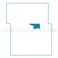
Outline

Summary
| Unique Area Identifier | 583685 |
| Name | PLEASANT VALLEY TWP Voting District |
| County | Webster County |
| State | Iowa |
| Area (square miles) | 11.17 |
| Land Area (square miles) | 10.94 |
| Water Area (square miles) | 0.23 |
| % of Land Area | 97.94 |
| % of Water Area | 2.06 |
| Latitude of the Internal Point | 42.45533840 |
| Longtitude of the Internal Point | -94.11369320 |
Maps


Graphs
Select a template below for downloading or customizing gragh for PLEASANT VALLEY TWP Voting District, Webster County, Iowa


Neighbors
Neighoring Voting District (by Name) Neighboring Voting District on the Map
- COLFAX TWP W/O DUNCOMBE Voting District, Webster County, IA
- COOPER TWP PART Voting District, Webster County, IA
- ELKHORN TWP Voting District, Webster County, IA
- OTHO TWP Voting District, Webster County, IA
- WASHINGTON TWP W/O DUNCOMBE Voting District, Webster County, IA
Top 10 Neighboring County Subdivision (by Population) Neighboring County Subdivision on the Map
- Otho township, Webster County, IA (901)
- Elkhorn township, Webster County, IA (734)
- Pleasant Valley township, Webster County, IA (718)
- Washington township, Webster County, IA (699)
- Cooper township, Webster County, IA (488)
- Colfax township, Webster County, IA (237)
Top 10 Neighboring Place (by Population) Neighboring Place on the Map
Top 10 Neighboring Unified School District (by Population) Neighboring Unified School District on the Map
Top 10 Neighboring State Legislative District Lower Chamber (by Population) Neighboring State Legislative District Lower Chamber on the Map
- State House District 49, IA (28,925)
- State House District 9, IA (27,314)
- State House District 50, IA (25,121)
Top 10 Neighboring State Legislative District Upper Chamber (by Population) Neighboring State Legislative District Upper Chamber on the Map
Top 10 Neighboring 111th Congressional District (by Population) Neighboring 111th Congressional District on the Map
Top 10 Neighboring Census Tract (by Population) Neighboring Census Tract on the Map
- Census Tract 9, Webster County, IA (4,924)
- Census Tract 104, Webster County, IA (3,105)
- Census Tract 101, Webster County, IA (2,464)
- Census Tract 5, Webster County, IA (1,675)